Global News
Before and After: Satellite Images Reveal Nepal’s Flood Tragedy
2 min read
By Timmy
Satellite images released this week reveal the dramatic transformation of the Bhote Koshi–Trishuli river corridor in Rasuwa, Nepal, after a catastrophic outburst flood on 26 August 2026.
The flood was triggered when a large section of glacier collapsed high in the Himalayas near the Nepal-Tibet border. The resulting surge of water, ice, rock and mud tore through river valleys, destroying villages, roads, bridges and hydropower infrastructure.
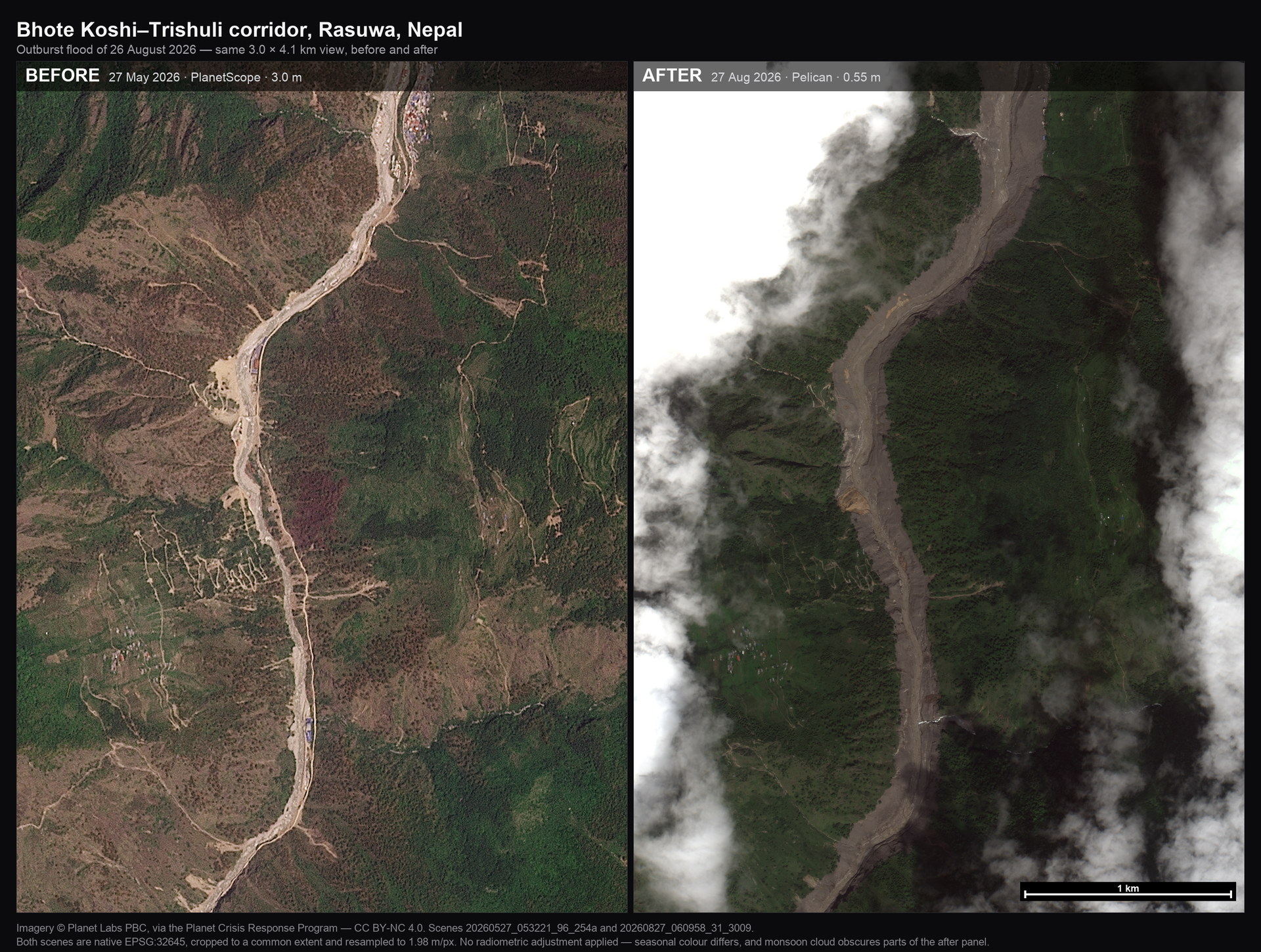
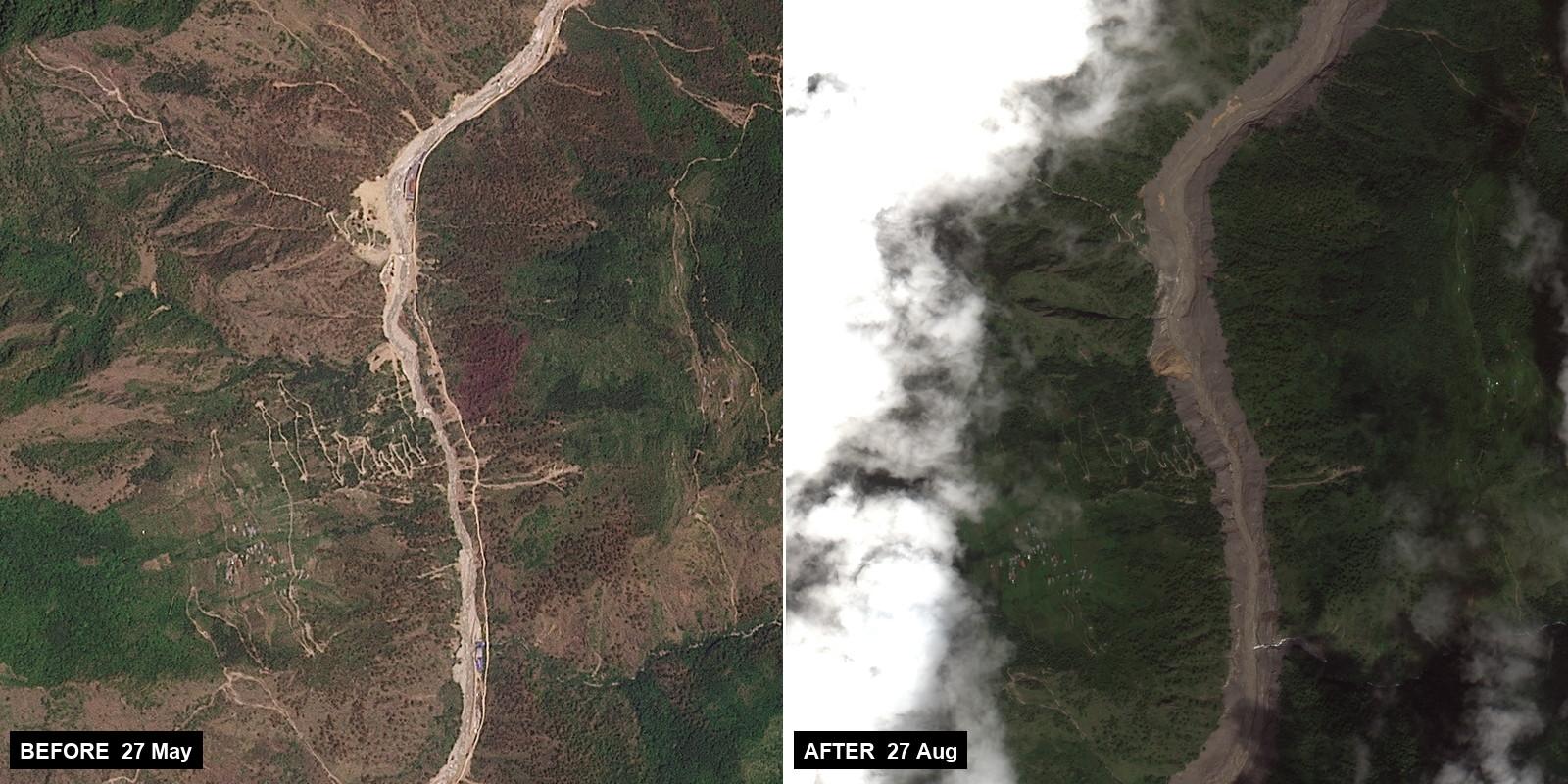
Before-and-after satellite imagery from Planet Labs clearly shows the scale of the destruction. Pre-flood images from May 2026 depict a relatively narrow river channel with visible roads and settlements. Post-flood images from 27 August show a much wider, debris-filled channel cutting through the landscape, with large areas buried under thick mud and sediment.
According to authorities, the disaster has killed at least 390 people, with more than 1,400 still missing across Nepal and Tibet. Hundreds of the missing are foreign nationals, including a large number of Indian pilgrims and workers. Rescue operations involving helicopters and ground teams continue, though damaged infrastructure and ongoing rain have slowed efforts.
Chinese officials have also warned of a secondary threat from a newly formed barrier lake that could breach and send another surge of water downstream.
The satellite comparisons provide one of the clearest visual records yet of how quickly and completely the landscape was altered by the flood.